AERIUM’s drone solutions have helped reduce forestry site inspection time from approximately four days to one day
AERIUM’s drone technology supports forestry producers across North America in improving management practices and ensuring regulatory compliance.
Utilizing our drone technology, geospatial intelligence, a automated data and surveillance capabilities forestry producers can address industry pain points around ineffective processes that impose high costs with limited scope and accuracy.
Our Forestry integrated drone solutions include:
Ineffective processes in the forestry industry impose high costs with limited scope and accuracy. Among the most significant of the industry’s pain points is the time and effort required to maintain accurate stockpile inventory calculations.
Following harvest, an operator will stockpile timber log decks either close to the mill location or on separate satellite yards prior to processing and pulping. Current inventory management practices are highly manual, risky, time consuming, and inefficient.
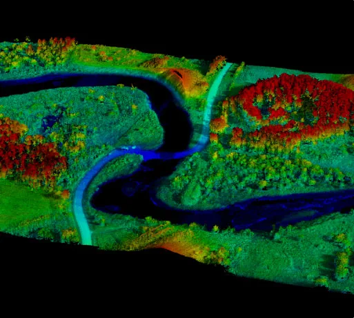
AERIUM’s geospatial intelligence solutions include improved aerial mapping capabilities that capture and measure fibre inventories, property features and boundaries, existing infrastructure locations and conditns, soil types, forest health and conditions, and wildlife habitats.
Our fibre volumetric solution streamlines this process and represents a significant and calculable impact for forestry companies. Applying drone-based measurement analytics to log deck measurement saves time and capital for forestry operators as well as providing more accurate inventory values for quarterly and annual financial summaries.
The forestry sector is one of the most dangerous industries in North America to work in. From falling timber to heavy equipment to the dangers inherent with working in remote locations, there is no shortage of worksite risks.
Furthermore, the forestry industry in Canada operates under a licence or timber supply agreement with the provincial or territorial government that has jurisdiction over the land. Each province has enacted separate legislation overseeing local forestry management practices, which must abide by strict regulations for sustainable harvesting, replanting, environmental stewardship, and forestry management, and often cover several years of operations.
These licences impose strict requirements for operators to uphold, leading to significant expenses in time and capital to uphold all compliance requirements. Ensuring compliance to their forestry management plan represents a significant and expensive challenge for companies.
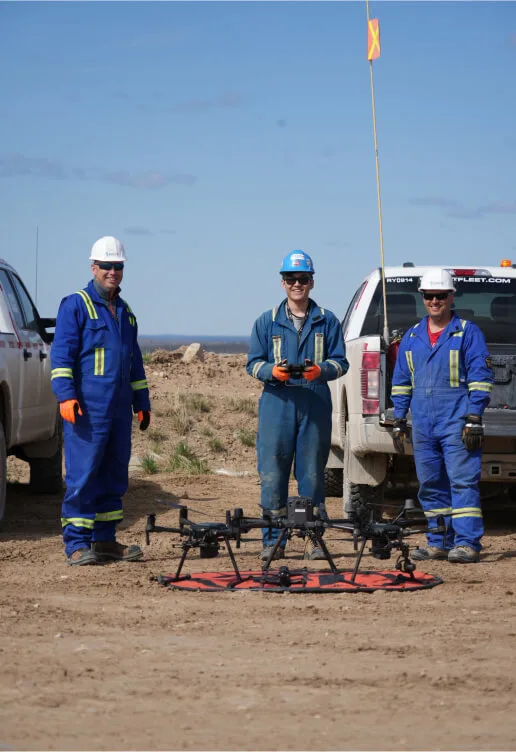
AERIUM’s drone solutions provide a safe and effective data collection alternative, keeping workers off risky worksites. AERIUM supports regulatory compliance and reporting schedules in line with forestry management plans. Our solutions help with the development of accurate and auditable governme reports and managing capital infrastructure liabilities. Integrated drone technology solutions save time and avoid potential fines, downtime, or seizure of timber.
AERIUM can provide illustrations of the current state of the forest land pre-harvest, calculate potential yield, and then offer monitoring and surveillance of reforestation efforts. The aim is to ensure forestry operations and related activities support the sustainable management of all forest resources for generations to come.
Learn more about Geospatial Intelligence solutions:
Learn more about Data Automation and Surveillance solutions:
AERIUM has worked with Alberta Pacific since 2014, providing forestry solutions including:
Interested in exploring how AERIUM’s proven solutions can support your forestry operation?
Supports the sustainable management of forest resources
Saves time and capital on log deck measurements
Provides more accurate inventory values for reporting
Employment from sustainable forest management in Canada is especially important for Indigenous and rural communities, where forest-related work is often a main source of income.
Not only do we hold ourselves to the highest standard of safety and regulatory compliance, but we also ensure our clients are equally diligent in adhering to industry regulations. This ensures potential areas of non-compliance are easily identified before they impact your business, resulting in the avoidance of safety risks and/or substantial fines.
Streamlining regulations, reducing liability, and minimizing environmental impact
Lorrnel Group, AERIUM’s sister company, is a profesonal services consultancy providing unparalleled value, return, and insights to the forestry, energy, mining, and logistics sectors for over 40 years.
Lorrnel partners with AERIUM fostering relationships with key stakeholders, which has been pivotal in the adoption of innovative drone solutions in the industry. AERIUM leverages Lorrnel’s fully functioning Geographic Information System department in support of geospatial drone services.