Revolutionizing business decision making with

Geospatial Intelligence

Pulling data out of the sky

Faster, better, more accurate technology for data collection

Providing best-in-class deliverables to the airport, energy, mining, and forestry sectors
Geospatial intelligence is the process of gathering and analyzing data to gain business insights – insights that can provide a true competitive advantage. AERIUM provides customized solutions to organizations by turning data into business intelligence.
Advantages to our geospatial intelligence solutions include:

See RoBird® in action

Our drone solutions architects integrate the best in technology solutions, focused on:
Aerium Analytics | Drone Technology Solutions - Competitive Advantage

Our drones are the safest and most effective data collection tools for complex industries

Delivering accurate and in-depth insights that will keep businesses ahead of the competition
Play Video

In any industry where geospatial intelligence is needed, AERIUM Analytics is there

Advantage #1: Rich data insights

Experience the power of in-depth operational information

In a world where data is increasingly available, those who know how to use it effectively will have a powerful advantage. AERIUM’s geospatial tools provide aerial reconnaissance, topographical, and inspection information for the safe and effective planning of both greenfield and brownfield projects. The use of imagery and digital twins assist project managers and engineers by providing more detailed and accurate data than traditional survey and aerial data collection methods.
Runway surface inspection at Calgary International Airport typically requires up to three days of runway shutdown. AERIUM can obtain the same data in four hours.
Applying drone-based measurement analytics to log deck measurement in the forestry industry provides more accurate inventory values.
Flare stack inspections for an oilsands producer were completed in one hour, where previously nine days of downtime were required.
AERIUM’s impact has been truly transformational for project management and safety. Drones utilize LiDAR, thermal, and multispectral sensors for site mapping and inspections, enabling a tremendous level of data collection.
Learn more about our custom, integrated solutions:

Advantage #2: Increased safety

A 100% success rate while working in high-risk zones

AERIUM’s solutions reduce potential exposure to heights and hazardous environments that may cause harm. By reducing the frequency of at-height activities or inspections of hard-to-reach areas, AERIUM reduces instances of high-risk activity for site workers.
Our geospatial intelligence provides remote operational and inspection capabilities that prevent potentially unsafe events, such as infrastructure malfunctions. AERIUM is proud of their record of zero safety incidents while onsite working in these complex environments.
S.O.L.E.

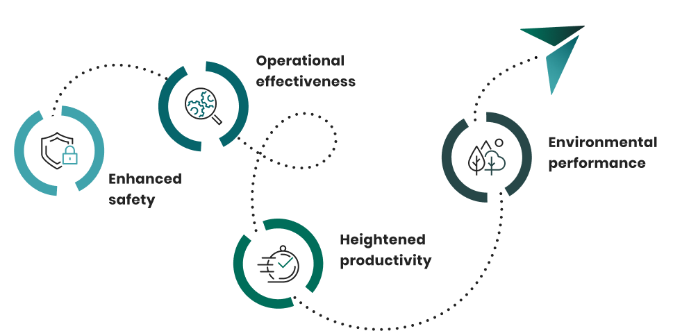
Our trademarked Safety Operations Learning Equipment Management System (S.O.L.E. Management System®) is our framework that we follow on every project. This system makes our clients safer by removing human personnel away from hazardous job sites.

By implementing S.O.L.E we are able to provide our clients with the peace of mind that comes with working in high-risk zones with a 100% success rate.

Advantage #3: Ability to access complex environments

Our drone solutions are designed to fly to spaces where drones typically can’t go
AERIUM supports aerial inspections ranging from small urban construction projects to vast forestry or energy sites. Crews can observe remote terrain that is not so easily be monitored on foot or with other land equipment.
This is just one of the reasons so many heavy hitters have chosen to partner with AERIUM.

Learn about our cutting-edge drone solutions

As AERIUM rapidly expands across North America we are developing innovative solutions to meet the demand of clients and service providers
Want to be kept in the loop on new developments?

Advantage #4: Full and comprehensive view of sites

Geospatial intelligence is an
indispensable tool for decision-makers
AERIUM provides a complete overview on industrial sites by delivering location referenced geospatial data in virtually any format that is compatible with construction and engineering software.
3D modeling and inspections conducted with enhanced data visualization provides thorough insights into the infrastructure condition, with the added benefits of cost effectiveness and increased productivity.
Not only does AERIUM provide this important data, but we help to turn it into action:

Advantage #5: Enhanced productivity

Powerful insights that save time and money through better informed decision-making

Through leveraging drone technology, AERIUM can survey sites faster than traditional methods, thereby providing consumers with required information for business decisions faster and more accurately.
Our geospatial intelligence solutions, including improved aerial mapping capabilities, have been game-changing in the forestry and silviculture industry, particularly in assisting with inventory management and regulatory compliance.

Geospatial intelligence is only one of our innovative solutions

We are a company of problem solvers. We listen, learn, identify pain points, and create customized solutions that solve major industry problems.
Our integrated solutions include:

A field-proven, effective technology for bird safety and damage mitigation

Turning data into action

A trailblazer in designing fully autonomous drone services and products

Driving ground-breaking advancements in drone applications for complex industries

AERIUM’s technical roadmap will accomplish the following:
Meet our team of experts:

Be the first to know about geospatial intelligence updates and other technological breakthroughs

Ready for richer operational insights?

Find out how AERIUM can make all the difference